
The Galileo programme is Europe’s initiative for a state-of-the-art global satellite navigation system, providing a highly accurate, guaranteed global positioning service under civilian control. The fully deployed system will consist of 30 satellites in Medium-Earth Orbit (MEO) and the associated ground infrastructure (currently 26 in-Orbit, 2022) . Consisting of 30-40 sensor stations, 3 control centres, 9 Mission Uplink stations and 5 telemetry, tracking and command (TT&C) stations. Galileo will be inter-operable with GPS and GLONASS, the two other global satellite navigation systems. The two Ground Control Centres (GCCs) constitute the core of the ground segment and includes two redundant stations located at Fucino (Italy) and Oberpfaffenhofen (Germany).
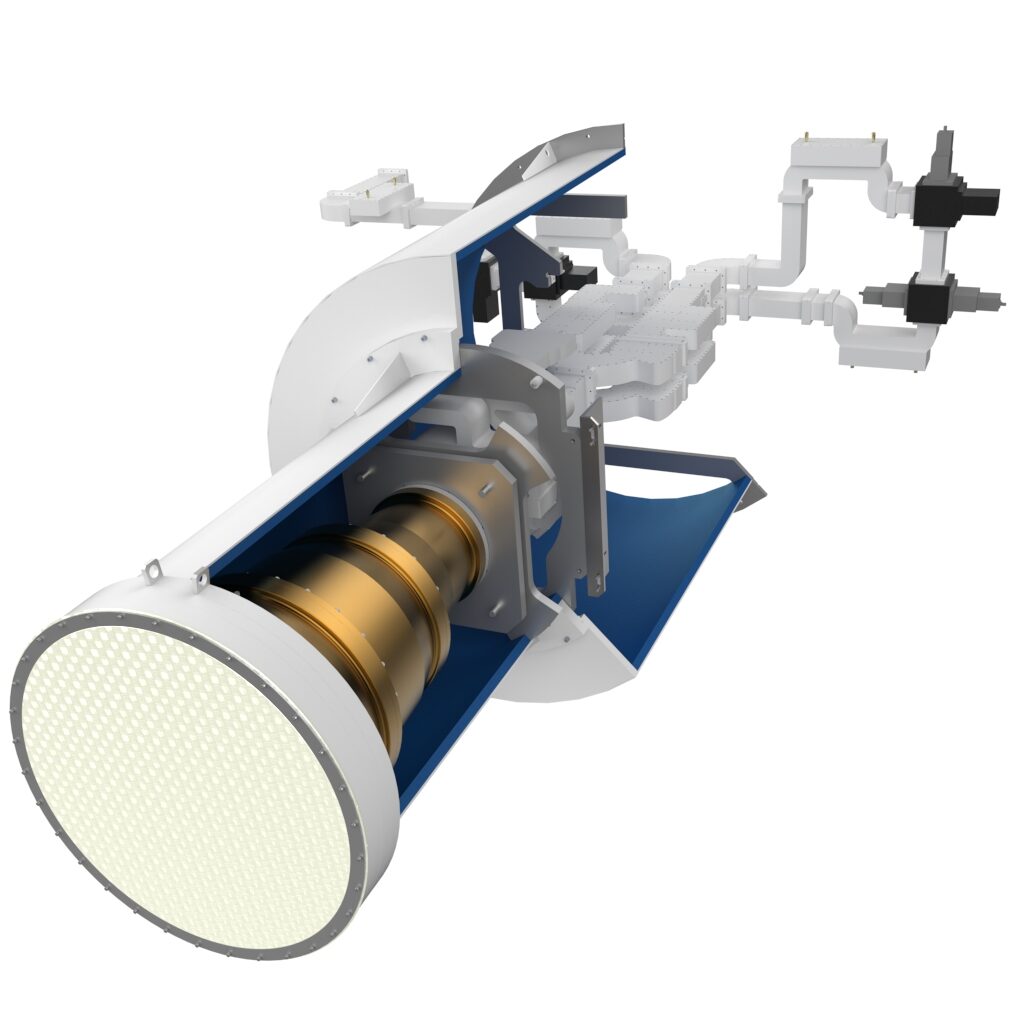
MIRAD was contracted to design, manufacture and deliver the first S-band feed system for the Galileo in-orbit validation (IOV) ground segment system in 2006. After successful development and testing in 2008, the first two units of the S-band tracking feed were delivered to our customers to be installed in 13m-class antennas, for which MIRAD also provided the reflector design. In 2011, two more units with an adapted design have been ordered and were successfully installed and have been in operation since 2014. As a result, MIRAD was able to manufacture and deliver a total of six S-band tracking systems for the Galileo ground segment by 2018.
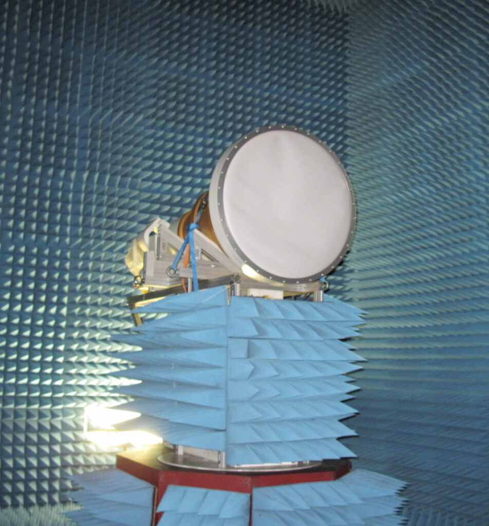
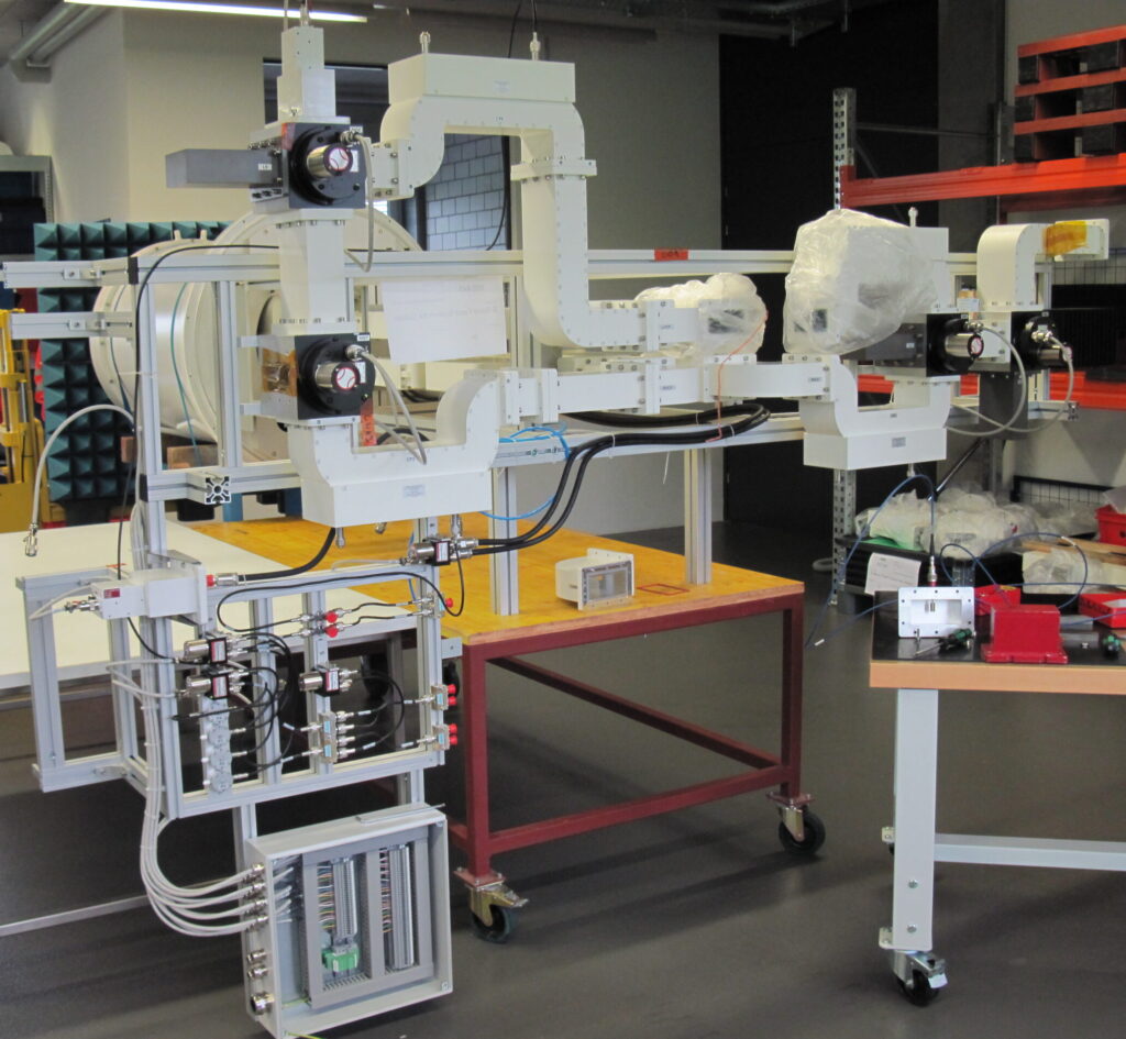
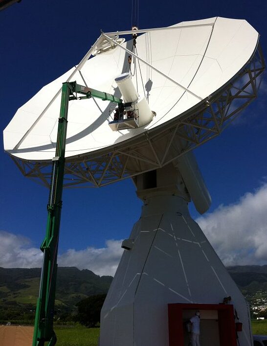
S-band feed system druring radiation pattern measurments in MIRADs anechoic chamber (left), final installation of the redundacy switching Rx & Tx network (center) and final installation of the feed in the 13m antenna on the site in La Reunion* (right)
Key technical challenges:
- Functionality at S-band frequencies
(Tx: 2.025 – 2.120 GHz, Rx: 2.200 – 2.300 GHz) - TE21 mode monopulse tracking capability
- High Rx/Tx Isolation (>120 dB)
- Very precise manufacturing of mechanical large structures
Key functionalities:
- Simultaneous signal reception and transmission
- Dual circular polariozation (RX, TX, Trk)
- Redundancy LNA switching network
- Harmonic Tx signal rejection
- Low Insertion Losses < 0.3 dB (Spec.: 0.5dB)
- Low Axial Ratio < 0.7dB (Spec.: 1.0dB)
Project partner:
ESA, SES, EADS Astrium (Airbus DS) UK, Indra Sistema S.A., CPI Vertex Antennentechnik GmbH, Hitec
*Credit: Galileo Ground Station Antenna, La Reunion 2014, CPI Vertex Antennentechnik GmbH